Scan headlines near Saint Paul with city and nearby coverage, source links, weather, ZIP codes, nearby cities, and local discovery links in one clean NewsSpoiler page.
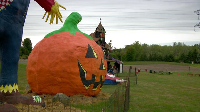
As the seasons change, it's time to start planning for fall fun, but getting to a popular spot in Lake Elmo, Minnesota, may look a little different this...
By MICHAEL MAROT BLOOMINGTON, Ind. (AP) — Backup quarterback Grant Wilson threw a 25-yard touchdown pass to Charlie Becker on the first play of overtime, a...
By MICHAEL MAROT BLOOMINGTON, Ind. (AP) — Backup quarterback Grant Wilson threw a 25-yard touchdown pass to Charlie Becker on the first play of overtime, a...
Burial mounds in Indian Mounds Park suggest Hopewell people lived in the area about 2,000 years ago. From the early 17th century until 1837, the Mdewakanton Dakota lived near the mounds at the village of Kaposia, and they called the place Imniza-Ska, "white cliffs," for its sandstone bluffs. In 1767 the explorer Jonathan Carver recorded the sacred cave Wakan Tipi below the mounds. Zebulon Pike obtained about 100,000 acres from the Dakota in 1805 for military use, and Fort Snelling was built in 1819. The 1837 Treaty with the Sioux ceded all Dakota land east of the Mississippi.
More about Saint Paul
Squatters, many of them French Canadians, gathered near the fort, and the commander evicted them for selling whiskey. The fur trader turned bootlegger Pierre "Pig's Eye" Parrant set up just outside the reservation, and by the early 1840s the settlement around his tavern was called Pig's Eye. In 1842 an Ojibwe raiding party attacked Kaposia, and the fight gave Battle Creek its name. In 1841 the Catholic missionary Lucien Galtier built a chapel named for St. Paul on the bluff above the landing and told the settlers to use its name instead of Pig's Eye. From the 1840s to the 1870s Metis traders brought buffalo hides down the Red River Trails to Saint Paul.
Harriet Bishop opened the first school in 1847. When Minnesota Territory was created in 1849, Saint Paul became its capital. In 1857 the legislature voted to move the capital to Saint Peter, but the legislator Joe Rolette stole the bill and went into hiding, so the move never happened.
Sources
Wikipedia: Saint Paul, Minnesota
Coordinates
45.0611320, -92.9548470
Local Time
7:03 PM America/Chicago
County
Washington County
Weather near Saint Paul
Local weather data is temporarily unavailable.
Hotels
Find hotel options near Saint Paul for visits, events, and local travel.
NewsSpoiler organizes Saint Paul coverage with city and nearby headlines, source links, maps, weather, ZIP codes, nearby cities, travel links, restaurants, and attractions so readers can move naturally through nearby local coverage.